
Leading up to the launch of my memoir Hangry: A Startup Journey, each month I’m releasing a state-by-state recap.
For the original post, click on any Day number heading.
Day 0: Chicago to Virginia Beach

I picked up the large 8-passenger van I was unexpectedly upgraded to. Good thing because my bike just barely fits. The next morning, I pulled out of my driveway at 2:45 am, left Chicago, and drove to Virginia Beach. After turning in the van, I grabbed a cab back to the motel. I’m ready to dip my wheel tomorrow.
Day 1: Virginia Beach to Jamestown
I started my cross-country adventure at the Atlantic Ocean in Virginia Beach. I could have started at the traditional Yorktown, but I wanted to start at the ocean proper. My choice leaves me with a few downsides: traffic from VA Beach to the TransAm route proper, a couple of brutally tall bridges, and there were not one but two ferries for me to use.

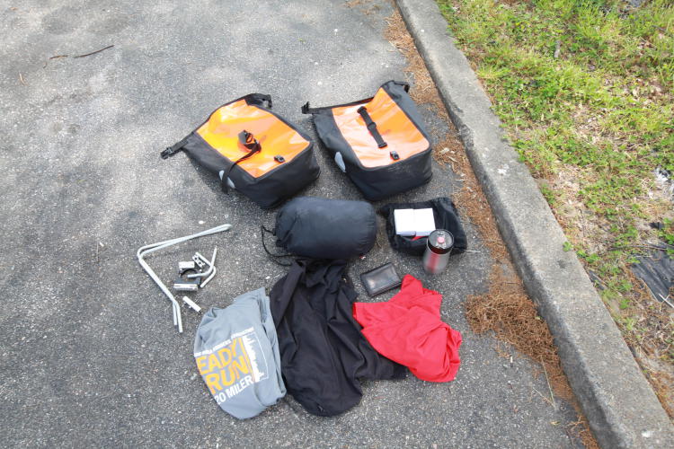
Two things jump out to me right away. First, people are stunned, friendly, and helpful when they find out what I’m doing. Second, there are lots of cool things to see along the way. I already realize I have too much stuff and am considering sending some back home in the next day or two.


Day 2: Jamestown to Ashland
Camping the first night after a strenuous ride was great. I slept soundly and woke up with only minor soreness. Again I thought I’ve got too much crap. My maps told me that Hwy 5 between the river and Richmond got very busy. I figured at 6 am, I’d beat a lot of traffic.

Battlefields are usually at the top of hills. One army decides to defend it against the assailant, as high ground is a valuable advantage. I rediscovered this concept of elevated battlegrounds at the Richmond Battlefield Park at the top of Malvern Hill. I noticed there was a gap in the Union line of cannons. So, I reinforced the line.
In the town of Glendale, I was shocked to realize my perspective had already taken a shift. I stopped at the local grocery store, where I stocked up on victuals—notably fried chicken. As the clerk rang me up, we exchanged pleasantries. In response to my “Have a good day!” she replied, “For sure I will!” Then it dawned on me Huh, what day is today? Who woulda thunk that after just two days of riding, I would already stop caring about the day of the week? Sweet.
Rolling into Mechanicsville, I spotted a Post Office. All those extra items I’ve been thinking about lightening from my load made their way into a box. I shed 9 lbs 8 oz from my pack.
I continued on, rolling the last 10 miles with little worth noting, except for an ice cream sandwich from 7-11. Overall, I’m much less tired than yesterday.
Day 3: Ashland to Mineral

Last night, as I rolled into the campground, I met three fellow bike tourers: John from Peoria and a married couple from Switzerland, Ruedi & Heida. We headed to the local Pizza Hut for dinner, where I proceeded to convince them to find a post office and dump some stuff!
The next morning, we were making our plans to “do our own ride” but meet up in the next town. We were torn on which next town we would stop at – 55 miles out, 75 miles out, or 105 miles out. Palmyra, the town at 75 miles out, did not appear to be a good stop with no motels, churches, or campable parks. Either go short or go long. With a sore knee, I was leaning towards a light day until lunch and then taking it easy, but my nature is to try and get to the longer goal.
This debate raged in my head for most of the early morning. I didn’t quit my job so I could have another job. I should just chill and relax. So I do, not only by taking off some of the distance, but also by going off the official TransAm trail. I turned off the main trail onto a side road, greeted with the most serene stretch of road with a canopy of green trees covering my path.
Mineral is as pleasant a biking experience as one could hope for. Bike lanes. Cute, old-timey charm on display. Even better, the local volunteer firehouse lets bike tourers camp and even sleep in the firehouse, space permitting. The campsite out back was completely full…WITH THE COUNTY FAIR! Forget the vegetables. I’m getting me a corn dog.

Day 4: Mineral to Afton
Today is going to be a long day with a moderate amount of vertical climbs into the foothills. Ten and a half hours later, I want to smack the snotty twerp that used the words “moderate” and “foothills” to describe what I experienced.
The day started rolling and pleasant. A little later, I was enjoying the gently rolling hills, realizing the previously challenging uphills were starting to get easier. I even got to see Monticello via a cool little bike path they have there.
It didn’t stay so picturesque. The next 30 miles turned into a grueling test of willpower as I climbed hill after hill. It was probably bigger than a hill, but smaller than a mountain. Now in Afton, I crash because tomorrow is 4,000 feet of vertical to get over the pass.


Pre-order my new book
Day 5: Afton to Vesuvius
Leaving Afton, I was filled with dread for the upcoming crossing of the Eastern Appalachian range. Crossing these mountains has been weighing in my mind since dipping my wheel in the ocean. Given the combination of their steep grade, elevation, and my physical condition this early in the trip, I was convinced this would be my hardest day. And the forecast has thunderstorms. Rather than charging up the mountain, I implemented a strategy to stop for pictures along the way, taking my sweet time getting up the mountain.


Bald Mountain is the end of the series climbing. I get to Hwy 56 and turn toward Vesuvius, realizing I had a fantastic time climbing this mountain! Deciding to stop and smell the roses, I decided to see what came along next with no planning. Just five minutes into my descent, I came across a lovely mountain B&B. And they had room, served dinner and breakfast, and yes, they would even make me a lunch basket.
Day 6: Vesuvius to Natural Bridge
The theme of today was leisurely riding. Wanting to get started at 4:30 am, I held off until the B&B got to serving the &B part at 8:30 am. Breakfast was well worth waiting for, and with some tiny regrets for not lingering an additional day, I said goodbye to the Sugar Tree Inn to make my way through Vesuvius. Exiting Vesuvius, I enjoyed 15 miles of the sweetest, gentle downhill a cyclist could ask for. Sadly, all good downhills come to an end.
Entering Lexington, I coasted past the Virginia Military Institute. In keeping with my chilled-out theme for the day, I decided to roll around the grounds and explore. Judging from the appearance of the campus, I’m pretty sure they teach art, beauty, culture, and love for one’s fellow man at VMI.

I serendipitously met up with Reudi, Heida, and John from my days back in Mineral. We sat around for about an hour and a half. John was struggling with fatigue and lethargy, and I agreed with him. I think I need to take a full day off here pretty soon.
Day 7: Natural Bridge to Christianburg

Right out of the gate, I felt much stronger than any day up to this point. I was back to taking the uphills with some aggressive cadence, instead of just hoping and praying the top would come soon. Natural Bridge was my first stop out of the campground. The bridge is a natural formation of limestone carved by the river below.
The next 35 miles are major highway, so I plow through it with little regard for the small towns and scenery. The towns themselves are much more interesting as one gets away from the interstates and highways anyway.
At Troutville, the path cuts sharply away from civilization and up into the high country parallel to the Appalachian Trail. I had been hoping that I’d see the intersection of the trail and some hikers, and that in fact happened. I met a through hiker named Josh. I would have missed the unmarked trail completely if the two of us hadn’t gotten to the intersection of the AT and the TransAm bike trail at the same moment.

The next 40 miles was a moderate climb with gently rolling hills full of beautiful pastures, mountains, and little streams. As I came around Depot Street in Christianburg, I hit the end of my first ACA TransAm map. The intersection isn’t much to look at, but I have a great sense of accomplishment for crossing this road.
Day 8: Christianburg to Wytheville

Frequent steep hills tired me greatly, perhaps too much relative to some of my prior climbs. I end up in Draper at the Junction Bike Shop. Owner Thomas has become a fixture on the TransAm trail in just two short years of opening. Aside from inspecting a cross-country biker’s rig, he also doles out advice.
Appalachian Virginia was cool temperatures and ethereal mists this morning. There was a fragile beauty to the scenery as I coasted by. Riding along New River, it captures much of the water from the mountain basin I’ve been riding through for the last 100 or so miles.

He told me on his TransAm trip in 2012 he got very fatigued and low mileage days weren’t refreshing him. After a full day off the bike, he was completely recharged. He strongly advised for me to take a rest day soon.
The next 20 miles were an incarnation of evil itself. It took almost four hours in the blazing sun to reach the town of Wythville. Running on fumes, I rolled up to a B&B that looked promising for a two-day rest. Unfortunately, they were booked so I made my way to the nearest Comfort Inn. On the way, I met Phil and Linda, also traveling cross-country.

After checking in and passing out for about an hour, we met up at the 1776 Restaurant, a place I had heard about through the cyclist grapevine. From fresh vegetables to IPA on draft, it was wonderful, considering finding any vegetables the last eight days was nearly impossible. I’m tapped and ready for a day off.
Day 10: Wytheville to Rosedale
When I woke up, I had the weather report from the night before weighing on my mind, including phrases like heavy rain, thunderstorms, and flash flood warning. To my great relief, the weather forecast by morning had improved, moving past me by 100 miles east by the time I woke up.

Rerouting onto an alternate route that is more direct, it allowed me to not only cut 15 miles off but to two great towns I would have otherwise missed: Marion and Chilhowie.
Marion is a town of about 8,000, which feels like a major metropolis along this route. Complete with a rush hour and frenzied big city life. But for all that, it has one of those really great little downtown main street sections that is very pretty. I think I passed 4 or 5 big, picturesque brick churches through the main part of town.
The next town is Chilhowie, which I might have blown through if not for the sign on the first building coming into town: Chilhowie Drug Store and Coffee Shop. Charlie, the cafe owner, whipped me up some biscuits and gravy along with a nice strong locally roasted cup of coffee. It was heaven. We chatted for a spell about my trip and a little about his daughters. Charlie went above and beyond with hospitality and didn’t charge me for my breakfast.
This is an important point about this trip. A lot of folks expected me to run into “crazies” and other dangerous elements on the road. But the vast majority of people have been kind, gracious, and hospitable. People are amazing.


Day 11: Rosedale to Duffield
Today, I broke away from the ACA route and started heading straight west. I’m looking to connect with my brothers north of Nashville for an annual get-together. I made my way through Lebanon, looking for and purchasing a hard copy map just in case, and out onto a highly trafficked county road. Constantly looking in my mirror, I kept an eye out for any trucks or particularly aggressive-looking cars.

Finally off the main road, I found myself on a ridge running through farming and residential areas. Merging back into my original directions past the US highways was quite pleasant. Little traffic and the hills became more manageable. My route for the next 3 days takes me over the Cumberland Mountains with minimal vertical and traffic.
Day 12: Duffield to Cumberland Gap National Park
Just a few miles outside of my campground, I turned off the major road onto a Virginia county road. It was a 6xx numbered road, which I’ve gathered means, “Kind of a real road, but kind of just a path into the backcountry” as opposed to a 7xx road which means “I guess some people call this a road” or even a 1xxx numbered road which means, “For reals, not a road.” It was a cool, damp day with a fog hanging over the valley. The road twisted and meandered, sometimes climbing, sometimes falling. Very gentle. Perfect. I came around one twist and saw this lone homestead with a column of smoke coming from the chimney.
Let’s not think this trip is going to be all beautiful vistas and zen-like serenity. Not one mile from the idyllic ‘lone homestead’ scene, I stumbled into the “WTF South.” Seriously. WTF. Apparently, I found Jim Bob’s Stage Coach Graveyard and Shrine to Disney, the South, Naked Ladies, and Skeletor.

I also noticed a strong uptick in the number of canines. Today I found myself chased by around 40 dogs. I’m not exaggerating and some of them meant business. My classification system of dogs for the bike tourer is below:
- Level 1: Harumphing Disapprovers. Your basic, laid-back dog. They hate you but they don’t care to exert their energy.
- Level 2: Terrified Guardians. These dogs know they hate you, but don’t know what to do about it.
- Level 3: Downhill Chasers. These guys decide to go for it. The reason this is labeled ‘downhill’ refers to the bike orientation, not the dog. If you are going downhill, you can outrun them.
- Level 4: Uphill Chasers. Starting to get serious. Time to kick in some acceleration and get away. Funny how the legs don’t feel fatigued anymore.
- Level 5: Uphill Interceptors. Uh Oh! They saw you coming and got a full head of steam before you were even close. The trick here is to blast your whistle as loud as possible while veering off to the other side. This scares the s!$# out of the pooch, downgrading them to a Level 4.
- Level 6: Uphill Gravel Road Bulldog Interceptor with Attitude. OH SHIT! OH SHIT! OH SHIT!

The final 10 miles of the day were riding along the Cumberland Mountains and approaching the Cumberland Gap. I’m looking forward to Kentucky tomorrow.